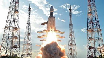
India is all set to use space technology in a big way, including by launching a satellite for exclusive use of the Home Ministry, to tone up border security and management. Home Minister Rajnath Singh has approved a report of the task force set up by his ministry to identify the areas for use of space technology in toning up border management. India shares land borders with Bangladesh, China, Pakistan, Myanmar, Nepal and Bhutan.
Under the five-year project to use space technology for improving border management, the Indian Space Research Organization will launch a satellite for exclusive use by the Home Ministry, an official statement said. The launch of the satellite is envisaged as a mid-term measure to implement the project over the next five years, according to the statement. Satellite communications will guide deployment of federal paramilitary forces in remote areas where access is difficult. Indian Regional Navigation Satellite System (IRNSS)-based GPS will provide navigation facilities for security forces carrying out operations in high altitude, remote and difficult borders and Maoist areas.
In the short term, immediate needs of the Border Guarding Forces (BGFs) will be met by procurement of high-resolution imagery and hiring of bandwidth for communications.
Over the long term, the Home Ministry will develop ground segment and network infrastructure to share satellite resources by user agencies, develop a Central Archival Facility for storing various imagery resources and dissemination of the same to user agencies, according to the statement.
The task force, headed by Joint Secretary (Border Management) in the Home Ministry and having members from BSF and the Department of Space, consulted all stakeholders including Border Guarding Forces (BGFs), Indian Space Research Organization, National Security Council Secretariat (NSCS) and the Defence Ministry to finalise the report.
The report has identified five important areas for use of space technology — island development, border security, communication and navigation, GIS and Operations Planning System, and border infrastructure development — the Home Ministry statement said.


